
Mexico Address Validation
What is Address Validation?
In an increasingly interconnected world, precision and efficiency in data management are crucial for the success of any business activity. How can you ensure that your business addresses are accurate and up to date?
Address Validation is the process of assuring that an address really exists when compared to a verified reference data base.
The MexicoGISData Address Validation Database
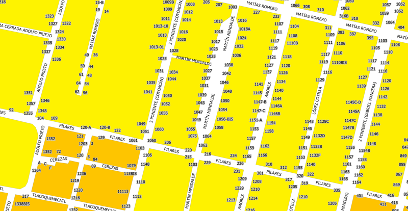
Addresses in Mexico are made up of the name of the street, the interior number, the exterior number, the name of the neighborhood, the city where it is located, as well as the municipality, the state and the postal code. Exterior numbering is alphanumeric in many places.
The validation process consists of comparing address input data with a verified database that measures address validity as a percentage of parameter correspondence. If all parameters match, there is 100% validity. If most of the parameters match, there will be a partial validity, for example when the input postal code does not match but the rest of the parameters do.
Contents
- 19,438,482 addresses,all at entry-level precision with location coordinates.
- Coverage of 67,268 locationsand 31,651 postal codes, effectively over 98% of all officially listed postal codes in Mexico.
- Data includes 106,800 settlements (Colonias), 934,186 interior house numbers in Mexico City, and 1,550,473 street-level addresses nationwide.
- Unique 46,698 kilometer markers on roads and highways with postal assignments, critical for logistics and transport.
This depth and precision are unmatched by non-local providers. Our intimate understanding of the Mexican Address System—including regional nuances, local naming conventions, and postal complexities—ensures unparalleled reliability and usability for your projects.
With MexicoGISData, you’re not just getting data—you’re gaining local expertise to power your operations with confidence.
Street Level Addresses
- Coverage of 1,550,473 streets, both urban and rural.
- In 26,387 locations throughout the country.
- With 23,099 zip codes
- In more than 106,800 settlements (Colonias).
- Represented by Line Geometry with coordinates corresponding to the centroid within the Settlement (Colonia) in which the street segment is located.
Addresses with External House Number
- Coverage of 19,438,482 external house numbers.
- In 4,493 cities with more than 2,500 inhabitants.
- Represented by point geometry at the entry point.
Interior House Number Addresses for Mexico City
- 934,186 interior numbers in various buildings in the city.
- Point geometry located at the centroid of the building polygon.
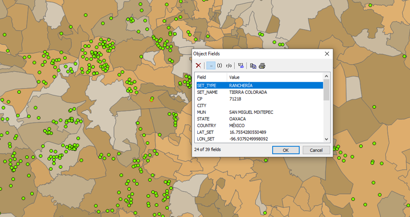
Settlements with no Streets, with Postal Allocation.
In Mexico there are a large number of settlements that do not have streets, but do have a postal assignment that allows them to be located as postal addresses. Such is the case of airports, ranches, camps, haciendas, farms, stations, ports, communal towns, among other classifications.
This data layer contains 40,881 such settlements located in 8,552 zip codes.
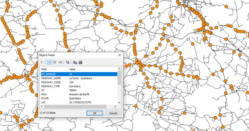
Kilometer Markers on Major Highways and Roads with Postal Assignment.
In Mexico, it is common to use a kilometer delimiter on a highway as part of a postal address. This information layer contains 46,698 postal-mapped kilometer markers on 3,226 highways in the country and 9,987 zip codes coverage.
Data sets are available in GIS formats as well as CSV and is provided on a licensing basis.
Interested in a sample or quote?
To learn more on how our Mexico address dataset can power your operations, please contact us.