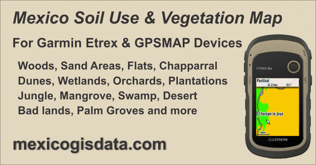
Mexico Soil Use and Vegetation GPS Map, Mexico’s land use mapping for Garmin eTrex and GPSMAP family devices.
Mexico Soil Use and Vegetation GPS Map is a conversion and adaptation of the 1:100,000 scale digital cartography issued by SEDENA (https://datos.gob.mx/busca/dataset/carta-general-de-la-republica-mexicana, under the “Open Data” scheme) to a vector format compatible with Garmin eTrex and GPSMAP GPS device families, widely used in the professional field. Source data is updated to 2020.
Contents
Mexico Soil Use and Vegetation
Polygons layer representing the soil use and vegetation data classified as follows:
Sand Areas. Woods, Chaparral, Water bodies, Dunes, Flats, Mud, Orchard, Bad land, Mangrove, Desert bush, Snow, Wetland, Palm grove, Swamp, Jungle, Pasture land, Populated areas, Saline, Plantation, Desert Vegetation and Flooding area.

Roads and Cities
Layers with main roads throughout the country plus cities and towns represented as points to provide context for the location of soil and vegetation areas.

Mexico Soil Use and Vegetation GPS Map Features
Coverage of the entire country divided into 17 segments identified by zones following the classification used by INEGI as shown in this image

Compatible with Garmin Basecamp program through an installer for PC and from which the map is loaded into the GPS device.
Designed so that soil use and vegetation data is displayed on the GPS device from a 3 km zoom when set to a normal map detail level.
By changing the GPS map detail level to Maximum, the soil use and vegetation data will be shown from the 12km zoom.
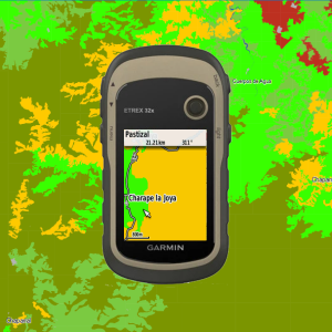
When hovering a feature that make up the map with the cursor in the GPS, the identification data will be displayed in the upper left part of the screen. Similarly in Basecamp, it will highlight a box with the item’s information.
Acquisition and Installation Information
Price: 1,160.00 pesos includes VAT
$1,160.00Add to cart
Mexico Soil Use and Vegetation GPS Map is available as an Installer compatible with Basecamp on Windows from which it is sent to the GPS. It allows you to select between uploading the entire country or only those regions that are of interest.
Only available for Windows operating system. This installer is not compatible with the Mac platform.
Garmin’s Basecamp shall be already installed in your computer. It may be downloaded for free from Garmin’s website at https://www.garmin.com/es-MX/software/basecamp/
Activation code
In order to view and use the map on both Basecamp and GPS, an activation code is required. To issue your activation code you shall provide us with the GPS ID number in which the map will be used.
The GPS ID is a 10-digit number that is a unique digital identifier for your GPS.
There are two ways to get your GPS ID:
With Basecamp
- Connect the GPS to PC and turn it on.
- Start Basecamp
- On the left side you will see the GPS model and its ID number
Directly from the GPS
Etrex models and GPSMAP series
- Turn on the GPS
- Go to the Settings menu (wrench icon)
- Select About
- The device ID appears at the top
Send us your GPS ID to generate the map activation code.
License
The indicated price grants a single license to be used on a single GPS device. An unlock code tied to the GPS ID will be issued allowing it to be viewed specifically on that device. This license is not transferable to another GPS device under any circumstances, including damage, theft or loss of the registered GPS device.
Return policy
Once the map unlock key is issued, returns are not accepted. Likewise, returns will not be accepted for errors or omissions in the cartographic and navigation information on land. In any case, the pertinent corrections will be made and sent to the user.
Billing
If an invoice is required, it must be requested at the time of placing the order, providing the corresponding fiscal data.
We will not be able to generate an invoice if it is not requested simultaneously with the order.
The acquisition, installation and/or use of this map is considered as an acceptance of the exposed terms.
Memory requirements and compatibility
The size of the entire map is 212 Mb. It is compatible with Garmin GPS devices capable of using maps, is compatible with Basecamp and have sufficient memory capacity to accept the map files, either in internal memory or through a card.
Installation and Unlocking
Follow our Installation and Unlocking instructions for Mexico GIS data mapping products