Geographic Information Systems (GIS) and GPS work hand in hand. They share a close relationship where one feeds the other in a continuous cycle. GPS devices are used to collect field data that can then be transferred to a GIS to update changed features, add new ones, and generally keep everything as up-to-date as possible, as explained in our guide to Field Surveys with Garmin GPS.
Did you know that this process can also work in reverse? In other words, you can convert your GIS data into a GPS compatible map for use in the field, which can facilitate and accelerate the maintenance of your GIS data, ultimately helping to improve your business performance or activity.
Our GIS to Garmin Map Conversion Service
For over 20 years, we have been fully dedicated to the development of GPS-compatible maps, starting in 2006 under our sister brand, BiciMapas. Our innovative creation, MexicoGPSAtlas, marked a significant milestone in the realm of digital maps with its cutting-edge autorouting capabilities.
In addition to traditional GPS mapping methods, we have also ventured into the creation of specialized maps for businesses and professional fields. For instance, our Mexico GIS Geological Map, GPS Land Use and Vegetation Map of Mexico, and Mexico Mining Map are specifically tailored for Garmin GPS devices, including the eTrex and GPSMAP series, offering ease of use.
Leveraging our extensive knowledge and experience in both technologies, our GIS to Garmin Map Conversion Service seamlessly transforms your valuable data into a Garmin-compatible vector format. Once uploaded to your devices, this transformation significantly enhances your field data collection experience, substantially increasing your business’s productivity.
Whether your business belongs to the fields of agriculture, mining, forestry, conservation, land surveying, archaeology, natural resource management, construction, environmental conservation, geology and geophysics, wildlife conservation, and related fields, enhance your operations with our specialized worldwide coverage service that smoothly transforms professional GIS data into a Garmin-compatible map format.
Empower your team with a robust field data collection tool by incorporating your own GIS data as a custom map on your handheld Garmin GPS devices, such as the eTrex and GPSMAP series. Then, easily transfer the collected data back to your GIS for seamless integration.
From optimizing crop management strategies to ensuring sustainable forestry practices, our conversion process empowers the agricultural and forestry sectors to make informed decisions based on accurate spatial information and precise navigation data.
For mining and geology professionals, our solution provides a comprehensive understanding of terrain features and resource distribution, facilitating efficient exploration and extraction activities while meeting strict environmental regulations and conservation efforts.
Conservationists and environmental experts can leverage our services to create detailed maps for wildlife tracking, habitat monitoring, and biodiversity conservation, contributing to the preservation of delicate ecosystems and natural resources.
Additionally, for construction, land surveying, and archaeology professionals, our conversion service ensures that each project is meticulously planned and executed, taking into account critical geographic data to optimize site management and preserve historical and archaeological sites.
With a focus on data integrity and security, our process ensures that your valuable GIS data remains confidential and accurate throughout the conversion process.
Unlock the full potential of your GIS data with Garmin-compatible maps and revolutionize the way you navigate and manage your professional activities. Contact us today to learn more about how our services can take your operations to new heights!
A Vineyard Design Case Study

We will demonstrate how this process works through an example that shows how GIS and Garmin devices can facilitate vineyard planning.
A new vineyard project is underway, and a key activity is creating the planting design to achieve maximum productivity.
An important note: In this case study, we illustrate the GIS process used for this task based on research we conducted on vineyard information. We are not vineyard experts, and there may be other factors that should be included in this planning. The purpose of this case study is to demonstrate the GIS approach to this task.
Mapping Vineyard Parcels
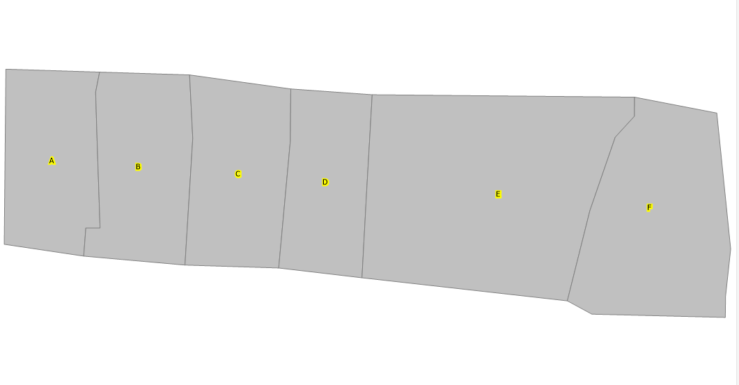
This new vineyard planting will have six parcels, each surrounded by a 10-meter-wide path.
The parcels were mapped using field GPS data collection, which was then added to GIS software. Each parcel was identified with a letter from A to F, as shown in this image.
Delimiting the Planting Area in Each Parcel
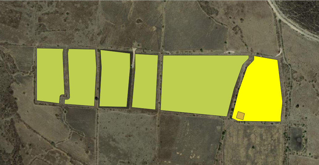
Various factors were used to determine the suitable planting area, including the need for a 10-meter-wide path surrounding each parcel to allow the movement of vehicles and equipment, as well as the spacing requirements for vine planting. According to our research, the spacing for Vitis vinifera (wine grapes) should be 1.8 to 3 meters between plants and 1.8 to 3 meters between rows.
The planting boundaries were calculated considering the required path width and a 3-meter margin to keep the plants away from the path. This image shows the generated planting areas in blue.

Planting Line Location
Taking into account the recommendations for Vitis vinifera, a GIS processing method was used to create the planting lines with 3 meters of spacing between them. This process was carried out for each parcel, as shown in this image.
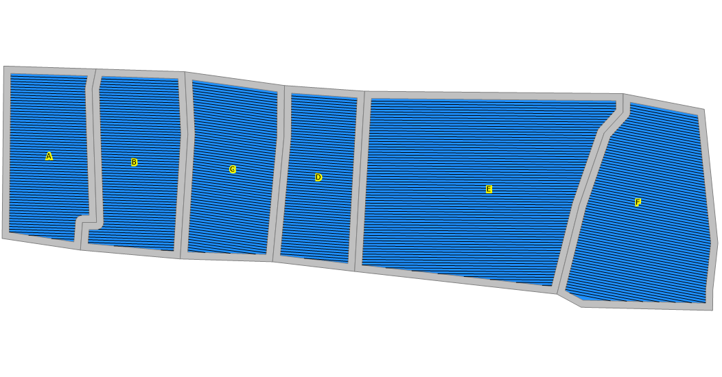
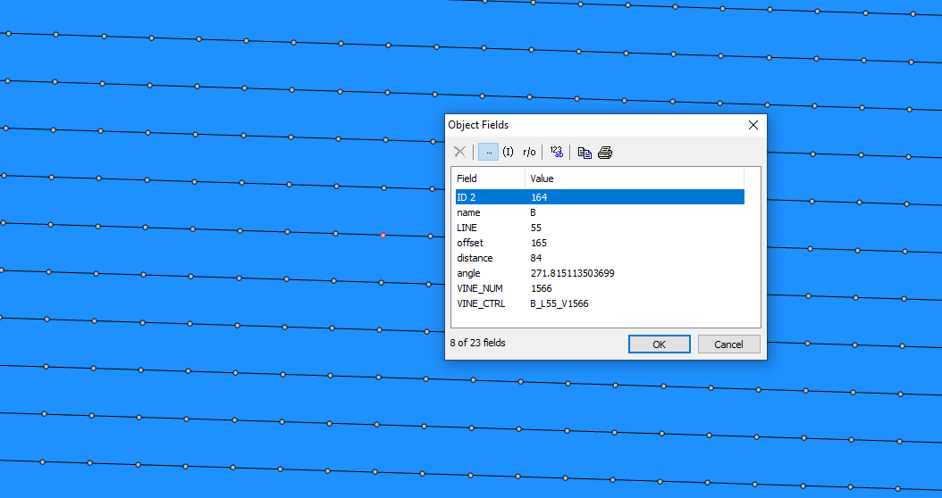
As part of this geoprocessing method, an identifier was also created for each line. This would allow for easy identification of each line within a parcel, as shown here.
Location of Vine Plants Along the Lines
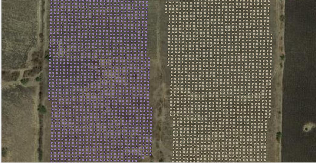
Following the same logic as before and using the recommended spacing of 3 meters, the location of each vine was established along the lines. Each point in this image represents the planting location of a vine.

As a result of this process, the potential number of vine plants per parcel is obtained:
Parcel A: 1,679 plants.
Parcel B: 1,890 plants.
Parcel C: 1,862 plants.
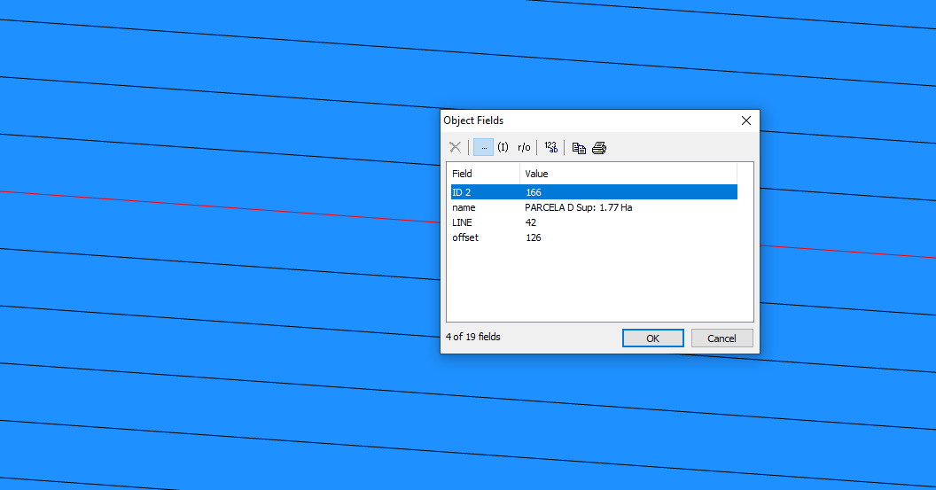
Parcel D: 1,477 plants.
Parcel E: 5,179 plants.
Parcel F: 2,893 plants.
For a total potential of 14,980 plants.
With further processing, each vine was assigned a unique identifier that would be used for various tasks such as having an accurate location for each vine, adding and tracking agricultural and additional control information for each, such as maturity, pests, and more. This vine control number is a combination of the Parcel Identifier, the Line it is on, and an individual plant number.
Converting GIS Data Layers to a Garmin Map
The final step in this example was creating the Garmin-compatible GPS map. Vineyard design data, along with some additional features, were added to create the final map.
The Garmin map format is designed for recreational and outdoor navigation use, so there are limitations to consider when using it for professional purposes. We have developed our own procedures to work with these limitations, allowing us to create maps for professional use.
Once completed, the map is loaded onto a MicroSD card, which is then inserted into the device. The following screenshots show the map on a Garmin GPSMAP 65 device.
Overview of the Vineyard Plantation. The map was designed to be transparent so it can overlay the detailed Garmin map included with the device, allowing other features to be displayed as well.

Closer view showing the parcels and the paths that delineate them.
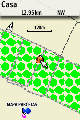
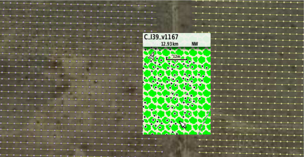
Each point on the map represents a vine plant, and when hovering over one of them, you can see its Vine Control Number at the top of the screen.


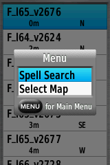
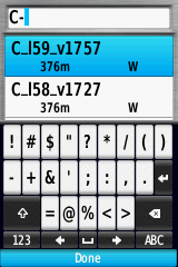
Vine plants can be searched using the control key, making them easy to locate and allowing the GPS to guide the user to their location.


Garmin GPS devices loaded with this map can now be used to transfer GIS data to the field as a complement to other agricultural processes used for vineyard planting.
In existing vineyards, creating a GIS project that includes the use of GPS devices for data collection to assist in the management process would be highly valuable.
The GPS map should be designed in a way that closely resembles your GIS data and intended use, which in most cases would involve collecting new data in the field as well as searching for included features to manage and update them.
Contact us so we can help you further leverage your GIS data to increase the productivity of your operations.